


The Midland Railway Assemblage Trail - self-guided tours of a selection of our objects in the Museum of Making.
For King and Country - the men who Joined Up in 1914 and those listed on the MR War Memorial.
Resources for modellers of Midland Railway locations or pre-grouping locos & stock
Including the searchable database of Carriage & Wagon drawings.
Information booklets published by the Midland Railway Society and downloadable without charge...
The Midland Railway Society Library - titles available to researchers at the Study Centre.
The Journal Index - a fully searchable index to the Midland Railway Society Journal.
Midland Railway Society Members - resources available exclusively to MRS members.
Some random images from our catalogue for you to enjoy...
Hover your mouse over the Item Number (or 'long press' on a mobile device) for more information

Item No. 64847
Rear view of ex-Midland Railway signal gantry north of Peterborough, photographed in 1961.
See also Item 64848 for more distant view.

Item No. 88-D1063
Arrangement and Details of Suspension Gear for Stone Liliput Type Dynamo Standard Carriages LMS Drg.No.5802

Item No. 30643
Parcel Label Type: LMS Transitional
Form No: P. F. 888. Print Ref: R 24.
Destination: Arley & Fillongley.
'Paid'

Item No. 66129
Nailsworth - ground level view of the exterior of the station building showing the covered entrance and part of the station forecourt. Some members of the station staff are posing for the photograph

Item No. 16192
Parcel Label Type; FROM
Form No; P. F. 838. Print Ref; R 2-5,000-5/06.
PAID. Parcel from EDWALTON To (Eastbourne LBSC)
MIDLAND RAILWAY DISTANCE DIAGRAMS
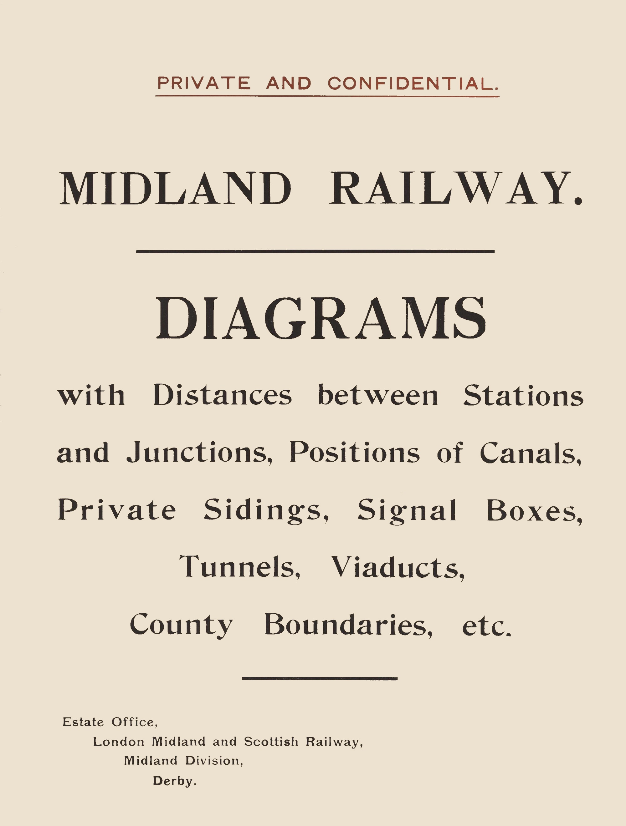
Most people who have had anything to do with the history of the Midland Railway will be familiar with the “Distance Diagrams”. Like the Company's two-chains-to-the-inch land plans and, out on the lineside itself, the distinctive mile posts, the Distance Diagrams were an essential part of how the railway was administered. Presented as enormous bound volumes, over 100 copies were distributed around the Company and a good many of them survive, dotted around various archives, museums and libraries. We are proud to have eight copies at the Midland Railway Study Centre and our friends at the National Archives just beat us with nine.
The Diagrams are an incredibly detailed record of the Midland Railway's network with every station, yard and private siding marked — crucially with the distances between them presented in extraordinary detail. What adds to the complexity of their story, however, is that they were kept updated. Revisions were issued periodically with all sheets being completely replaced at least once over the years. Most books were dutifully updated by their custodians and so we are largely left with a picture of the Midland Railway as it became during the LMS period after 1923. Importantly, however, not all copies were so assiduously updated, and it is these copies which are particularly interesting. Notes and a spreadsheet compiled by the late Pat Larkam provide much more details in this regard below.
That all said, even the updated copies present us with a fascinating insight into the detail of the Midland Railway's system.
You can download a PDF of Distance Diagrams Book 44, including the Index Gazetteer sheets and the Alterations Sheets from 1911 to 1923. This is a 47.9Mb file. If you only want a copy of an individual sheet, please email your request to the address below.
Perhaps the most definitive account of the history of the Distance Diagram Books can be obtained from this Reference Paper written by John Gough.
Notes about different editions of the Distance Diagrams compiled in 1978 by the late Pat Larkam
The first edition was issued in 1873 entitled Midland Railway Diagrams – the word “Distance” was added to the second and last issue of 1893.
The table below shows the date of each diagram. The missing first edition dates are presumably all 7.1873, although there is some doubt in the case of 1G for instance, where the Settle and Carlisle was not opened until 1875, after that year’s amendments. Was there therefore some issued in 1876?
The title page of the 1st edition is 1873-4. Were there any amendments issued in 1874? Up to and including 1906 the date on the bottom right hand corner of each sheet included the month – usually January. Subsequently only the year was stated.
In the table, the month is shown only where it is definitely known from an example still in existence.
Over the 52 years of issue the layout changed, gradually including more and more information. This aspect could be the subject of a separate investigation.
The 1873 edition was issued by “The Engineer’s Office” and the 1893 edition by “Estate Agent’s Office” – both “Midland Railway, Derby”.
Sizes:
1873:- 21” high x 16” wide x 2½ thick – Bright Red.
1893:- 20¾” high x 16” wide x 3½ thick – Very Dark leather.
Known Editions for Each Sheet
| Sheet | Title | 1st | 2nd | 3rd | 4th | 5th | 6th | 7th | 8th | 9th | 10th | 11th |
| 1 | Stranraer District | 1.1886 | 1914 | |||||||||
| 1a | Newton Stawart - Glenluce District | 1.1886 | 1914 | |||||||||
| 1b | Newton Stewart | 1.1886 | 1914 | |||||||||
| 1c | Castle Douglas | 1.1886 | 1914 | |||||||||
| 1d | Dumfries - Castle Douglas | 1.1886 | 1914 | |||||||||
| 1e | Annan - Dumfries | 1.1886 | 1914 | |||||||||
| 1f | Gretna District | 1.1886 | 1914 | |||||||||
| 1g (1) | Carlisle District | 1878 | 1882 | 1.1885 | 1904 | 1914 | ||||||
| 2 | Appleby District | 1.1.1878 | 1904 | 1914 | ||||||||
| 3 | Hawes Junction & District | 1.1879 | 1903 | 1913 | ||||||||
| 4 | Hellifield & Ingleton | 7.1873 (10) | 1878 | 1881 | 1.1888 | 1901 | (2) | 1910 | 1913 | |||
| 4a | Blackburn District | 1.1888 | 1895 | 1913 | ||||||||
| 4b | Bolton District | 1.1888 | 1895 | 1913 | ||||||||
| 4c | Ormskirk - Houghton District | 1.1888 | 1895 | 1913 | ||||||||
| 5 | Carnforth - High Bentham | 7.1873 | 1881 | 1901 | 1909 | 1916 | ||||||
| 6 | Morecambe – Heysham - Lancaster | 1.1884 | 1905 | 1909 | 1917 | |||||||
| 7 | Skipton District | 1881 | 1885 | 1.1888 | 1900 | 1909 | 1915 | |||||
| 8 | Bradford District | 1877 | 1885 | 1.1888 | 1.1899 | 1906 | 1912 | 1920 | ||||
| 9 | Leeds - Royston | 7.1873 | 1877 | 1879 | 1886 | 1898 | 1905 | 1910 | 1917/1918 | |||
| 9a | Leeds & District | 1895 | 1905 | 1910 | 1918 | |||||||
| 10 | Rotherham District | 1879 | 1883 | 1.1887 | 1898 | 1905 | 1909 | 1919 | ||||
| 10a | York District | 1879 | 1.1888 | 1907 | 1920 | |||||||
| 10b (5) | Cudworth District | 1879/1905 | 1893/1909 (3) | 1916 | ||||||||
| 10c (5) | Doncaster District | 1.1882/1906 (4) | 1910 | 1918 | ||||||||
| 10d | Hull | 1.1882 | 1893 | Cancelled 1907 Edition unknown |
||||||||
| 10e | Millhouses - Rotherham - Brighton | 1.1882 | 1893 | 1898 | 1906 | 1909 | 1918 | |||||
| 10f | Rotherham - Swinton & District | 1902 | 1909 | 1913 | ||||||||
| 11 | Moorthorpe District | 7.1873 | 1896 | 1907 | 1920 | |||||||
| 12 | Chesterfield | 1877 | 1878 | 1.1883 | 1885 | 1.1889 | 1900 | 1904 | 1907 | 1909 | ||
| 13 | Southern Erewash | 1877 | 1879 | 1.1883 | 1898 | 1908 | ||||||
| 13a | Derby | 1904 | 1908 | 1917 | ||||||||
| 13b | Trent | 1897 | 1904 | 1908 | 1917/1918 | |||||||
| 13c | Langley Mill District | 1897 | 1904 | 1908 | 1921 | |||||||
| 13d | Ambergate District | 1898 | 1908 | 1920 | ||||||||
| 14 | Matlock District | 1.1884 | 1902 | 1910 | 1913 | |||||||
| 15 | Buxton District | 1.1883 | 1886 | 1903 | 1911 | 1915 | ||||||
| 15a | Huddersfield District | 1886 | 1911 | 1915 | ||||||||
| 15b | Dore & Totley District | 1894 | 1905 | 1912 | 1915 | |||||||
| 16 | Manchester District | 1875 | 1880 | 1886 | 1888 | 1902 | 1895 | 1914 | 1923 | |||
| 17 | Warrington & Northwich District | 7.1873 | 1880 | 1902 | 1914 | |||||||
| 18 | Chester & Widnes District | 1875 | 1880 | 1.1888 | 1902 | 1914 | ||||||
| 19 | Liverpool District | 1880 | 1885 | 1.1888 | 1897 | 1906 | 1914 | |||||
| 19a | Southport District | 1885 | 1.1888 | 1910 (5) | 1914 (5) | |||||||
| 20 | Mansfield Worksop & District | 1880 | 1885 | 1.1889 | 1899 | 1907 | 1912 | |||||
| 21 | Nottingham & District | 7.1873 | 1877 | 1880 | 1886 | 1899 | 1907 | 1912 | ||||
| 21a | Nottingham & District | 1899 | 1907 | 1913 | ||||||||
| 22 | Newark District | 1.1883 | 1904 | 1913 | ||||||||
| 23 | Lincoln District | 1.1883 | 1904 | 1915 | ||||||||
| 24 | Leicester District | 7.1873 | 1880 | 1886 | 1908 | 1916 | 1923 | |||||
| 25 | Ashby District | 11883 | 1899 | 1906 | 1912 | 1920 | ||||||
| 26 | Tamworth District | 1877 | 1.1884 | 1896 | 1905 | 1912 | 1921 | |||||
| 26a | Tamworth - Water Orton District | 1879 | 1.1883 | 1901 | 1910 | 1915 | ||||||
| 26b | Burton on Trent | 1.1884 | 1902 | 1915 | ||||||||
| 26c | Uttoxeter - Leek | 1.1896 (6) | ||||||||||
| 26d | Stoke on Trent | 1.1896 (6) | ||||||||||
| 27 | Wolverhampton District | Issued 9.1876 |
1879 | 1.1883 | 1899 | 1912 | 1920 | |||||
| 28 | Melton Mowbray District | 1880 | 1884 | 1887 | 1.1888 | 1900 | 1911 | 1915 | ||||
| 28a | Saxby & Bourne Line | 1.1888/1894 | 1907 | 1913 | ||||||||
| 29 | Manton District | 1880 | 1.1884 | 1899 | 1912 | 1923 | ||||||
| 30 | Bourne - Peterborough | 1.1883 | 1894 | 1908 | 1916 | |||||||
| 31 | M & GN Holbeach - Murrow | 1.1883 | 1894 | 1912 | ||||||||
| 32 | M & GN Sutton Bridge - Kings Lynn | 1.1883 | 1894 | 1912 | ||||||||
| 32a | M & GN Massingham District | 1894 | 1912 | 1921 | ||||||||
| 32b | M & GN Fakenham District | 1894 | 1912 | 1921 | ||||||||
| 32c | M & GN Melton Constable | 1894 | 1912 | 1921 | ||||||||
| 32d | M & GN Norwich District | 1894 | 1912 | 1921 | ||||||||
| 32e | M & GN North Walsham District | 1894 | 1.1907 | 1921 | ||||||||
| 32f | M & GN Yarmouth - Lowestoft | 1894 | 1904 | 1916 | ||||||||
| 33 | Wigston Rugby | 1.1887 | 1897 | 1908 | 1916 | |||||||
| 34 | Market Harborough District | 7.1873 | 1886 | 1904 | 1913 | |||||||
| 35 | Kettering - Wellingboro | 7.1873 | 1.1.1877 | 1880 | 1886 | 1895 | 1905 | 1911 | 1914 | |||
| 36 | Kettering - Thrapston - Huntingdon | 1.1887 | 1905 | 1911 | 1916 | |||||||
| 37 | Huntingdon - St Ives | 1.1884 | 1907 | 1916 | ||||||||
| 38 | Cambridge | 7.1873 | 1907 | 1916 | ||||||||
| 39 | Northampton | 7.1873 | 1904 | 1911 | 1919 | |||||||
| 40 | Bedford District | 1.1888 | 1895 | 1905 | 1911 | 1914 | 1920 | |||||
| 41 | Hitchin District | 7.1873 | 1905 | 1911 | 1913 | |||||||
| 42 | Luton District | 1.1.1877 | 1.1889 | 1896 | 1908 | 1915 | ||||||
| 43 | Hendon District | 1879 | 1.1884 | 1900 | 1908 | 1915 | 1919 | |||||
| 44 | London District | 1.1883 | 1886 | 1901 | 1913 | |||||||
| 44a | London District | 1.1888 | 1901 | 1914 | ||||||||
| 44b | London District East | 1.1888 | 1901 | 1914 | 1919 | |||||||
| 44c | London District Clapham | 1.1900 | 1915 | |||||||||
| 44d (7) | London District Hitherg | 1900 | 1915 | |||||||||
| 45 (4) | LT & S Upminster | 7.1873/1913 | 1.1893 | (3) | ||||||||
| 45a | LT & S Tilbury - Pitsea | 1913 | ||||||||||
| 45b | LT & S Southend | 1913 | ||||||||||
| 46 | Nuneaton - Whitacre | 1878 | 1.1889 | 1896 | 1908 | 1916 | ||||||
| 47 | Birmingham District | Not Dated | 1.1.1877 | 1879 | 1886 | 1897 | 1906 | 1913 | ||||
| 48 | Bromsgrove District | 1.1884 | 1902 | 1912 | 1914 | |||||||
| 49 | Alcester - Evesham - Ashchurch | 1.1883 | 1902 | 1912 | 1918 | |||||||
| 49a | Stratford on Avon District | 1923 | ||||||||||
| 49b | Towcester District | 1923 | ||||||||||
| 50 | Worcester District | 7.1873 | 1895 | 1.1906 | 1913 | |||||||
| 51 | Cheltenham - Gloucester - Stonehouse | 1.1884 | 1897 | 1911 (8) | ||||||||
| 51a | Severn & Wye (GW & MR Joint) | 1886 | 1897 | 1910 | 1917 | |||||||
| 52 | Stonehouse to Yate & Branches | 7.1873 | 1881 | 1897 | 1910 | 1913 | ||||||
| 53 | Mangotsfield - Bath - Bristol | 1878 | 1887 | 1.1888 | 1898 | 1910 | 1918 | |||||
| 53a | Bristol District | 1910 | 1914 | |||||||||
| 54 | GWR Ledbury District | 7.1873 | 1.1906 | 1915 | ||||||||
| 55 | Hereford District | 7.1873 | 1895 | 1.1906 | 1911 | 1915 | ||||||
| 56 | Hay District | 1.1889 | 1907 | 1911 | 1921 | |||||||
| 57 | Brecon District | Not Dated | 1907 | 1911 | 1923 | |||||||
| 58 | Colbren Junction District | 1875 | 1.1.1877 (9) | 1.1889 (9) | 1908 | 1911 | 1923 | |||||
| 59 | Swansea Vale Lines | 1875 | 1877 | 1.1884 | 1.1893 | 1903 | 1.1904 | 1911 | ||||
| 59a | Swansea Vale Lines | 1.1884 | 1.1902 | 1911 | ||||||||
| 60 | S & D Bath - Evercreech | 1.1887 | 1905 | 1917 | ||||||||
| 61 | Glastonbury | 1.1876 | 1906 | 1918/1919 | ||||||||
| 62 | Highbridge - Bridgewater | 1.1889 | 1910 | 1919 | ||||||||
| 63 | Templecombe | 1.1876 | 1910 | 1919 | ||||||||
| 64 | Blandford | 1.1876 | 1910 | 1919 | ||||||||
| 65 | Bournemouth | 1.1888 | 1910 | 1919 | ||||||||
| 66 | Ashby Canal | 1878 | 1.1906 | |||||||||
| 67 | Cromford Canal | 1.1906 | 1924 | |||||||||
| Map Index | 1910 | 1920 | ||||||||||
| Index to Diagrams | 1.1886 | 1912 | ||||||||||
| Burton & Ashby Light Railway | Date Stamp 18 July 1913 | |||||||||||
| Notes: | ||||||||||||
| (1) Renumbered from No.1 in 1886 | ||||||||||||
| (2) Apparently Not Issued | ||||||||||||
| (3) Second Issue presumably cancelled but date unknown | ||||||||||||
| (4) Two series for different areas | ||||||||||||
| (5) Redrawn with amendments but both fourth editions | ||||||||||||
| (6) Cancelled 1920 | ||||||||||||
| (7) Sheets 44E, 44F, 44G mentioned but not issued 1895 | ||||||||||||
| (8) Issued in 1910 amendments | ||||||||||||
| (9) Redrawn with amendments but both 2nd editions | ||||||||||||
| (10) 88-1997-5/269B | ||||||||||||
The Midland Railway Study Centre web site
is maintained by Dave Harris, the Study Centre Co-ordinator
Email: enquiries@midlandrailwaystudycentre.org.uk
The Museum of Making at Derby Silk Mill
Silk Mill Lane, Derby, DE1 3AF.
Our Privacy Policy.
No cookies are set by us. However, our hosting service adds traffic analysis cookies over which we have no control and have no ability to opt-out from.
Page last updated: Friday, 16 August 2024